 |
Id: 1335, Quality: 5Group: tcn2025Location: Tanner Farm campsitePostcode: TN12 9NDMap Reference: 51.1474, 0.47568Ride length: 75 kmRide ease: AverageAdded by: Philip Ingram | A ride through the verdant flatlands of the Low Weald through Headcorn and Grafty Green. Then uphill through the woods before crossing the M20 and heading for the Pilgrims Way along the lower slopes of the Downs. Then to onto the lovely buildings of Aylesford Priory and Aylesford. Then heading back ... |
 |
Id: 1356, Quality: 4Group: tcn2025Location: Tanner Farm campsitePostcode: TN12 9NDMap Reference: 51.147, 0.476405Ride length: 32 kmAdded by: Philip Ingram | Bewl Water 800-acre parkland is unlike anywhere else, with miles of scenic pathways to walk or cycle and other water based activities. Scotney Castle has a ruined medieval castle, a Victorian mansion house, rolling parkland, ancient woodland and a picturesque garden. With romance, drama and nature a ... |
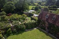 |
Id: 1352, Quality: 4Group: tcn2025Location: Tanner Farm campsitePostcode: TN12 9NDMap Reference: 51.1469, 0.476448Ride length: 25 kmAdded by: Philip Ingram | Sissinghurst Castle, a refuge dedicated to beauty. Vita Sackville-West and Harold Nicolson fell in love with the castle and created a world-renowned garden. This short route loops round to the castle from the east along some lovely generally flat lanes. It is an ideal route to fill in an afternoon b ... |
 |
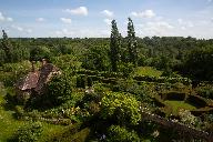
Id: 1341, Quality: 4Group: tcn2025Location: Tanner Farm campsitePostcode: TN12 9NDMap Reference: 51.1474, 0.475674Ride length: 48 kmRide ease: EasyAdded by: Philip Ingram | A lovely quiet route to Tenterden. Tenterden is always worth a visit with its Georgian architecture, antique shops, heritage railway and interesting museum. It is very good for a potter and there are plenty of cafes. The return is equally lovely and quiet. Thankyou to Anne Charlotte Holman for the p ... |
 |
Id: 1340, Quality: 4Group: tcn2025Location: Tanner Farm campsitePostcode: TN12 9NDMap Reference: 51.1467, 0.476721Ride length: 94 kmAdded by: Philip Ingram | There is almost too much to see on this ride! The route follows the same roads as the Medium ride up to Belmont House. After leaving the Belmont the route drops you down the east side of the North Downs into the historic market town of Faversham. Then recrosses the Downs to rejoin the medium route a ... |
 |
Id: 1336, Quality: 4Group: tcn2025Location: Tanner Farm campsitePostcode: TN12 9NDMap Reference: 51.1473, 0.475871Ride length: 121 kmRide ease: HardAdded by: Philip Ingram | A ride through the verdant flatlands of the Low Weald through Headcorn and Grafty Green. Then uphill through the woods before crossing the M20 and heading for the Pilgrims Way along the lower slopes of the Downs. Then to Rochester, Cyclopark and Aylesford Priory. Then heading back towards and along ... |
 |
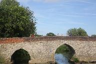
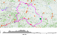
Id: 1334, Quality: 4Group: tcn2025Location: Tanner Farm campsitePostcode: TN12 9NDMap Reference: 51.1473, 0.475793Ride length: 55 kmAdded by: Philip Ingram | A ride through the verdant flatlands of the Low Weald through Marden, Chainhurst to the quaint village of Yalding. Crossing the Medway at Nettlestead and up the hill towards Ditton before finally reaching Aylesford with its ancient bridge, narrow street and Priory. |
 |
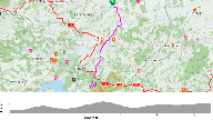
Id: 1594, Quality: 2Group: tcn2025Location: BN16 2ATPostcode: BN16 2ATMap Reference: 51.1473, 0.475926Ride length: 51 kmAdded by: Philip Ingram | An undulating morning ride through the woodland and orchards of the High Weald. An opportunity to visit a children's farm and playground at the coffee stop, before dropping down to the wide vistas of the Medway Valley. This area was famed for its hop farms. Alas, now all replaced with either arable ... |
 |
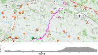
Id: 1355, Quality: 2Group: tcn2025Location: Tanner Farm campsitePostcode: TN12 9NDMap Reference: 51.1471, 0.474845Ride length: 11 kmAdded by: Philip Ingram | Bedgebury Pinetum is home to a world-leading collection of conifers and contains over 12,000 specimen trees. The trees and landscape create a beautiful setting for peaceful walks and picnics. It has activities for both Adults and Children. Note: This route is one way so reverse it for the return whi ... |
 |
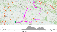
Id: 1354, Quality: 2Group: tcn2025Location: Tanner Farm campsitePostcode: TN12 9NDMap Reference: 51.1471, 0.476166Ride length: 20 kmAdded by: Philip Ingram | There are so many things to do at Leeds Castle and it's more than just a great day out. It is a place of contrasts from thrilling experiences to tranquil escape and quiet reflection. You really need a full day to get the full benefit so this lovely route will get you there mainly along the quiet lan ... |
 |
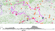
Id: 1353, Quality: 2Group: tcn2025Location: Tanner Farm campsitePostcode: TN12 9NDMap Reference: 51.1471, 0.476166Ride length: 53 kmAdded by: Philip Ingram | There are so many things to do at Leeds Castle and it's more than just a great day out. It is a place of contrasts from thrilling experiences to tranquil escape and quiet reflection. This route loops out through the lovely country side to the East before turning North towards the castle. The loop it ... |
 |
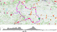
Id: 1351, Quality: 2Group: tcn2025Location: Tanner Farm campsitePostcode: TN12 9NDMap Reference: 51.1471, 0.47627Ride length: 98 kmAdded by: Philip Ingram | A tour of the Grand Stately Houses of the Northwest Weald. An undulating morning ride through the woodland and orchards of the High Weald, before crossing the Medway valley at Tonbridge. |
 |
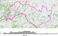
Id: 1350, Quality: 2Group: tcn2025Location: Tanner Farm campsitePostcode: TN12 9NDMap Reference: 51.1474, 0.475647Ride length: 66 kmAdded by: Philip Ingram | An undulating morning ride through the woodland and orchards of the High Weald, before crossing the Medway valley at Tonbridge. The route then heads for Ightham Mote followed by a climb onto the Greensand ridge. The climb is rewarded with a long decent back down into the Medway Valley at Hadlow. Thi ... |
 |
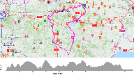
Id: 1349, Quality: 2Group: tcn2025Location: Tanner Farm campsitePostcode: TN12 9NDMap Reference: 51.1473, 0.475922Ride length: 42 kmAdded by: Philip Ingram | An undulating morning ride through the woodland and orchards of the High Weald. An opportunity to visit a children's farm and playground at the coffee stop, before dropping down to the wide vistas of the Medway Valley. This area was famed for its hop farms. Alas, now all replaced with either arable ... |
 |
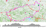
Id: 1348, Quality: 2Group: tcn2025Location: Tanner Farm campsitePostcode: TN12 9NDMap Reference: 51.1468, 0.476641Ride length: 105 kmRide ease: HardAdded by: Philip Ingram | This long and hilly route takes in some lovely villages and beautiful scenery. It heads out through to Goudhurst and then round to Bewl Water, through Wadhurst, the Rother valley, Burwash and then uphill to Brightling Down and south to Bodle Street Green before turning north west to Heathfield, Roth ... |
 |
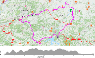
Id: 1347, Quality: 2Group: tcn2025Location: Tanner Farm campsitePostcode: TN12 9NDMap Reference: 51.1464, 0.477015Ride length: 67 kmAdded by: Philip Ingram | This route takes in some lovely villages and beautiful scenery. It heads out through to Goudhurst and then round to Bewl Water, through Wadhurst, and east to Mark Cross and along lovely back lanes to Erith Station and round to Groombridge. Then it turns east past High Rocks and onto Tunbridge Wells. ... |
 |
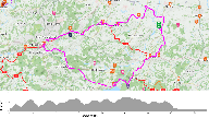
Id: 1346, Quality: 2Group: tcn2025Location: Tanner Farm campsitePostcode: TN12 9NDMap Reference: 51.1483, 0.474102Ride length: 54 kmAdded by: Philip Ingram | This route extends the short ride by including the lovely village of Wadhurst and some lovely but hilly back lanes to Bells Yew Green. This route passes some beautiful scenery. It heads out through to Goudhurst and then round to Bewl Water, through Wadhurst, Bells Yew Green and onto Tunbridge Wells. ... |
 |
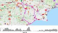
Id: 1345, Quality: 2Group: tcn2025Location: Tanner Farm campsitePostcode: TN12 9NDMap Reference: 51.147, 0.476405Ride length: 51 kmAdded by: Philip Ingram | This route takes in some lovely villages and beautiful scenery. It heads out through to Goudhurst and then round to Bewl Water, east to Bells Yew Green and onto the old centre of Tunbridge Wells, The Pantiles. The route heads back via Penbury, Matfield and Brenchly. |
 |
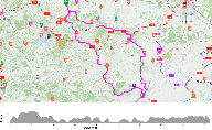
Id: 1344, Quality: 2Group: tcn2025Location: Tanner Farm campsitePostcode: TN12 9NDMap Reference: 51.1468, 0.476602Ride length: 111 kmRide ease: HardAdded by: Philip Ingram | A lovely route through Kent countryside before crossing the Kent Ditch before Bodiam, with its castle, into East Sussex. Then following local lanes to Battle before heading south west to Hastings and Battery Hill, overlooking the Channel. Then dropping down to the Rye nature reserve and then on to t ... |
 |
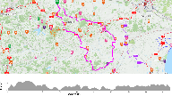
Id: 1343, Quality: 2Group: tcn2025Location: Tanner Farm campsitePostcode: TN12 9NDMap Reference: 51.1468, 0.476602Ride length: 83 kmAdded by: Philip Ingram | A lovely route through Kent countryside before crossing the river Rother into East Sussex following local lanes to Peasmarsh before heading south to the medieval town of Rye which is a 'must see' town. The route then heads to Tenterden which is always worth a visit with its Georgian architecture, an ... |
 |
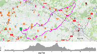
Id: 1342, Quality: 2Group: tcn2025Location: Tanner Farm campsitePostcode: TN12 9NDMap Reference: 51.1468, 0.476602Ride length: 75 kmAdded by: Philip Ingram | A lovely route through Kent countryside before crossing the river Rother into East Sussex following local lanes before recrossing the river back into Kent. This route stops short of Rye to keep the mileage down to a reasonable Medium ride. If you wish to go to Rye use the Medium Plus. The route head ... |
 |
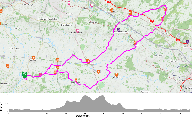
Id: 1339, Quality: 2Group: tcn2025Location: Tanner Farm campsitePostcode: TN12 9NDMap Reference: 51.1467, 0.476721Ride length: 77 kmAdded by: Philip Ingram | This route still takes you through Headcorn and out to Lenham on country lanes the same as the short route. From Lenham you head over the downs and wind you way through country lanes to Belmont house, famous for its clock collection. You then head back following a route through Charing and Pluckley ... |
 |
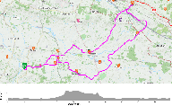
Id: 1338, Quality: 2Group: tcn2025Location: Tanner Farm campsitePostcode: TN12 9NDMap Reference: 51.1467, 0.476721Ride length: 67 kmAdded by: Philip Ingram | The short plus route still takes you through Headcorn and out to Lenham on country lanes the same as the short route. But instead of retracing your route out of Lenham you go across the A20 and up to the top of the North Downs for some great views. You then head back down and pick up the short route ... |
 |
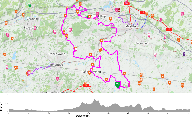
Id: 1337, Quality: 2Group: tcn2025Location: Tanner Farm campsitePostcode: TN12 9NDMap Reference: 51.1467, 0.476722Ride length: 60 kmAdded by: Philip Ingram | Route takes you through Headcorn and out on the country lanes to Lenham with its lovely church. Retrace your route out of Lenham for a short while before heading to Egerton and the through lanes to Staplehurst. Head back to Campsite from Staplehurst. |
 |
Id: 1333, Quality: 2Group: tcn2025Location: Tanner Farm campsitePostcode: TN12 9NDMap Reference: 51.1474, 0.475507Ride length: 91 kmAdded by: Philip Ingram | This ride will take you on an undulating journey through Paddock Wood, Hadlow, Borough Green & Wrotham. After crossing the A20, the route joins The Pilgrims Way which has lovely views. From here we head towards West Malling, then onto a short track through Gallaghers and over the wooden bridge cross ... |
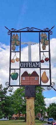 |
Id: 1332, Quality: 2Group: tcn2025Location: Tanner Farm campsitePostcode: TN12 9NDMap Reference: 51.1474, 0.475507Ride length: 82 kmAdded by: Philip Ingram | This ride will take you on an undulating journey through Paddock Wood, Hadlow and St Mary's Platt which will lead us to Offham where the long route rejoins. From here we travel towards West Malling and East Malling and then onto a short track through Gallaghers and over the wooden bridge crossing th ... |
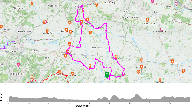 |
Id: 1331, Quality: 2Group: tcn2025Location: Tanner Farm campsitePostcode: TN12 9NDMap Reference: 51.1471, 0.476266Ride length: 45 kmRide ease: EasyAdded by: Philip Ingram | Lovely flat route through Paddock Wood, visiting the Medway and then back via Yalding and Marden |
